
Mukono Municipal Council
Mukono Physical Development Planning Framework
Establishment of Three (03) Local Detailed Physical Development Plans and Five (05) Corridor Area Action Plans across Ggulu, Ntawo, and Namumira-Anthony Wards. Harnessing analytical models for resilient urban growth.
Wards Population
95,489
Detailed Plans
03 Wards
Area Action Plans
05 Corridors
Handover Horizon
Oct 20, 2026


Spatial & Field Engagement Gallery
Local context imagery, draft layouts, and grassroots workshop consensus charts
Proposed Standardized Pedestrian Walkways
Kame Market activities have rendered the Kame Stream a waste collection centre. The design enforces integrated concrete paver walkways, formalized masonry drain channels, and solar-powered LED streetlamps to separate commercial trade from stormwater run-off.
Executive Framework Mandate
This strategic physical planning framework implements structural, ecological, and socio-economic planning solutions aligned with the Physical Planning Act, 2010 (as amended). Formally commissioned by the Town Clerk, Francis Byabagambi, on behalf of the Mukono Municipal Council, the project sets out statutory development buffers to regulate high-density commercial expansion, manage municipal hydrology, and safeguard critical infrastructure systems.
Ward planning boundaries
Establishing rigorous physical zoning books and density metrics for Ggulu Ward, Ntawo Ward, and Namumira-Anthony Ward.
Corridor spatial buffer rules
Implementing strict setback limits along high-friction transit corridors: Kame, Nakawolore, Njogeze, Ngandu, and Kigombya.
Macro-Level Project Milestones
Progress MatrixFormal mobilization finalized. Scope methodologies aligned, institutional stakeholders mapped, and the Inception Report (D1) presented to municipal executive committee.
Socio-economic diagnostic profiling, Google Earth Engine environmental model run, and structural compliance maps delivered. Baseline Map Book (D2) archived.
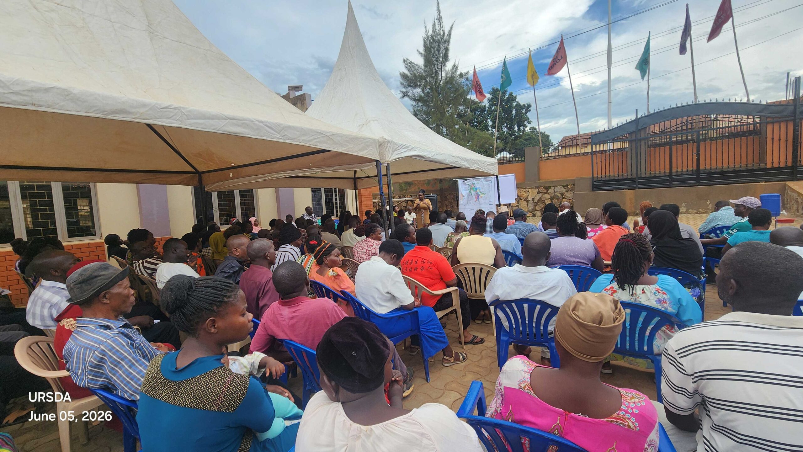
Grassroots public engagement workshops successfully hosted in Namumira-Anthony, Ggulu, and Ntawo wards on May 26 & 28, 2026. Local leader visioning matrices archived.
Active mapping of physical layout drafts (D3–D5) and corridor layout matrices (D6–D10) integrating structural building guidelines.
Mandatory 60-day public exhibition of maps, compilation of feedback objection grids, and final statutory handover to Council.
Spatial Diagnostics & Engineering Models
Access actual empirical diagnostics and stormwater modeling tools for the Mukono Central Division.
The central physical development framework anchors a combined baseline planning horizon of 95,489 total residents within the Ggulu, Ntawo, and Namumira-Anthony wards. Our spatial models analyze cell-level density grids:
39,432
~3,286 residents/cell (12 cells)
29,447
Central forest canopy
26,610
Agricultural assets
QA/QC Checklists & Spatial Archives
To maintain planning transparency, geolocated survey charts, ward attendance indexes, and verified maps are stored on our records portal.
Submit Stakeholder Commentary
Are you an LCI/LCII representative, municipal leader, or ward developer? Submit boundary concerns or observations to the Municipal Physical Planning Department.
Interactive 10-Year Planning Scenarios & Priorities
Simulate the decadal trajectory of Mukono Central Division by adjusting the planning horizon and policy framework. See real-time metrics mapped dynamically below.
95,489
Central Division: Ggulu, Ntawo, Namumira
15.0%
Current baseline
Environmental Resource Projections (Loss/Retention)
INPUT: [32.7513, 0.3584]
MODEL: GEE Sentinel-2 MSI
NDVI VALUE: +0.48
Source Verification & Fact Mapping Matrix
Outputs & Deliverables Registry
Formal D1 to D14 deliverables tracked against MMC requirements.
Project Oversight Team & Executive Committee
Under direct execution of the Mukono Municipal Council Physical Planning Committee, chaired by local division department leads, with executive statutory compliance guidance under the Office of Town Clerk Francis Byabagambi.
Statutory Frameworks & Guidelines
All physical plan books, geolocated baseline mapping registries, and zoning metrics conform explicitly with the National Physical Planning Standards & Guidelines (NPPSG) 2022 and the statutory mandates of the Physical Planning Act, 2010.